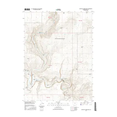
2016 Map of Canyon of Lodore South
USGS Topo · Published 2016About this map
Dinosaur National Monument defines this river landscape where the Green River and Yampa River meet. The confluence occurs at Echo Park, a point of significant topographical change overlooked by the massive profile of Steamboat Rock. This survey records the complex drainage systems of the eastern Plateau, including Whirlpool Canyon and the southern reach of the Canyon of Lodore. Named landmarks such as Jenny Lind Rock and Outlaw Arch sit alongside historical references to early resource exploration, noted by Iron Mine Ridge and Iron Mine Draw. The map documents a network of isolated meadows and flats like Box Elder Park and Menlo Park, connected by the Echo Park Trail, providing a clear view of the canyon floor access before modern landscape changes. High-altitude features like Wild Mtn and the Ant Hills mark the transition from river bottom to the high desert ridges.
Find a feature on this map
40 named features on this map. Tap any name to fly to it.
Don’t see what you’re looking for? This feature index may not catch every label — zoom into the map to look around manually.
Map Details
Editions of this 2016 Canyon of Lodore South Map
This is the sole edition of this map. No revisions or reprints were ever made.
Other maps of this area

1885 · Ashley
USGS Topo · 1:250,000

1907 · Rangely
USGS Topo · 1:125,000

1907 · Jensen
USGS Topo · 1:125,000

1910 · Jensen
USGS Topo · 1:125,000

1910 · Rangely
USGS Topo · 1:125,000

1954 · Hells Canyon
USGS Topo · 1:24,000

1954 · Canyon of Lodore South
USGS Topo · 1:24,000

1954 · Canyon of Lodore North
USGS Topo · 1:24,000

1954 · Vernal
USGS Topo · 1:250,000

1955 · Stuntz Reservoir
USGS Topo · 1:24,000