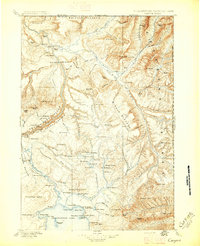
1896 Map of Canyon
USGS Topo · Published 1896About this map
Yanceys and a lone Hotel on the northern shore of Yellowstone Lake mark the rare human imprints in this late nineteenth-century wilderness. Surveyed by Frank Tweedy under the direction of Henry Gannett, this map documents the heart of Yellowstone National Park when access was still defined by early crossings like the Baronett Bridge. The terrain transitions from the geothermal activity at Calcite Springs and The Mudkettles to the steep relief of Specimen Ridge and the Fossil Forest. The hydrology of the era is preserved in the winding course of the Lamar River and the high Buffalo Plateau, offering a detailed record of the park’s natural landmarks before the modernization of park infrastructure. Researchers can trace the early trails leading toward Jones Pass and the isolated peaks of the Absaroka Range.
Find a feature on this map
132 named features on this map. Tap any name to fly to it.
Don’t see what you’re looking for? This feature index may not catch every label — zoom into the map to look around manually.
Map Details
Editions of this 1896 Canyon Map
2 editions found

Other maps of this area

1885 · Lake
USGS Topo · 1:125,000

1885 · Gallatin
USGS Topo · 1:125,000

1885 · Gallatin
USGS Topo · 1:125,000

1886 · Shoshone
USGS Topo · 1:125,000

1886 · Canyon
USGS Topo · 1:125,000

1888 · Shoshone
USGS Topo · 1:125,000

1891 · Livingston
USGS Topo · 1:250,000

1893 · Livingston
USGS Topo · 1:250,000

1893 · Ishawooa
USGS Topo · 1:125,000

1895 · Shoshone
USGS Topo · 1:125,000