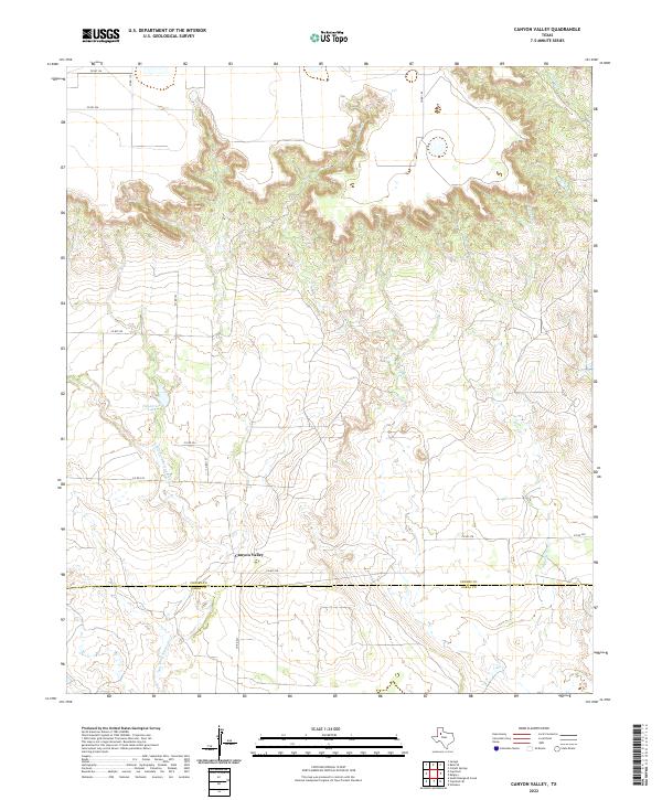
2022 Map of Canyon Valley
USGS Topo · Published 2022About this map
Canyon Valley serves as a central landmark in this portion of the Texas plains, situated near the dramatic breaks of the Llano Estacado. The topography is dominated by the deeply incised drainage of the Salt Fork Brazos River, which carves through the landscape alongside several prominent tributaries including Turkey Cr and McDonald Cr. This 2022 survey illustrates a transition from the level agricultural uplands to the complex canyon systems of the caprock. The winding course of Pigpen Cr and the presence of Henderson Lake emphasize the importance of water management in this arid environment. The map also delineates the boundary between Crosby County and Garza County, providing a clear record of modern property and jurisdictional divisions within this sparsely populated ranching and farming region.
Find a feature on this map
18 named features on this map. Tap any name to fly to it.
Don’t see what you’re looking for? This feature index may not catch every label — zoom into the map to look around manually.
Map Details
Editions of this 2022 Canyon Valley Map
This is the sole edition of this map. No revisions or reprints were ever made.
Other maps of this area

1954 · Lubbock
USGS Topo · 1:250,000

1966 · Cap Rock
USGS Topo · 1:24,000

1966 · Kalgary
USGS Topo · 1:24,000

1966 · Collett Springs
USGS Topo · 1:24,000

1966 · Canyon Valley
USGS Topo · 1:24,000

1967 · Ralls SE
USGS Topo · 1:24,000

1967 · Savage
USGS Topo · 1:24,000

1968 · South Dokegood Creek
USGS Topo · 1:24,000

1969 · Verbena
USGS Topo · 1:24,000

1969 · Cap Rock SE
USGS Topo · 1:24,000