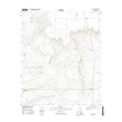
2016 Map of Cap Rock
USGS Topo · Published 2016About this map
Cap Rock sits atop the dramatic escarpment where the High Plains drop away into the broken canyonlands of the Texas Panhandle. This landscape is defined by the headwaters of the Brazos River system, featuring the complex drainage of the Salt Fork Brazos River and the N Fork Double Mountain Fork Brazos River. The topography transitions from the flat agricultural plains in the northwest, dotted with ephemeral basins like Caddell Lake and Janes Prentice Lake, to the deeply eroded breaks of the Llano Estacado. Landforms such as Courthouse Mtn and Indian Ridge stand as prominent landmarks among the labyrinth of draws and hollows, including Turkey Draw and Red Hollow. Along the southern border, the line between Crosby County and Garza County crosses the riparian corridor where Spring Cr and Harvey Creek converge, illustrating the rugged hydrologic network that has shaped the ranching and settlement patterns of this region.
Find a feature on this map
24 named features on this map. Tap any name to fly to it.
Don’t see what you’re looking for? This feature index may not catch every label — zoom into the map to look around manually.
Map Details
Editions of this 2016 Cap Rock Map
This is the sole edition of this map. No revisions or reprints were ever made.
Other maps of this area

1954 · Lubbock
USGS Topo · 1:250,000

1965 · Acuff
USGS Topo · 1:24,000

1965 · Southland
USGS Topo · 1:24,000

1965 · Slaton NE
USGS Topo · 1:24,000

1966 · Cap Rock
USGS Topo · 1:24,000

1966 · Canyon Valley
USGS Topo · 1:24,000

1967 · Ralls SE
USGS Topo · 1:24,000

1967 · Savage
USGS Topo · 1:24,000

1968 · South Dokegood Creek
USGS Topo · 1:24,000

1969 · Cap Rock SE
USGS Topo · 1:24,000