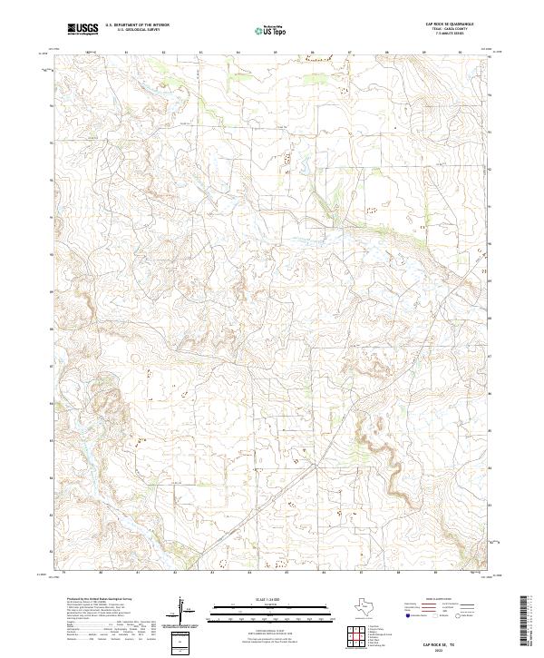
2022 Map of Cap Rock SE
USGS Topo · Published 2022About this map
The Salt Fork Brazos River and the North Double Mountain Fork Brazos River converge their drainage patterns in this corner of Garza County. The landscape is defined by the deeply etched drainage of Falls Cr and a network of county roads that navigate the varying elevations of the Cap Rock escarpment. This modern mapping effort by the U.S. Geological Survey details the sparsely populated ranching country where the Llano Estacado begins its descent. A skeletal frame of local infrastructure, including Co Rd 134 and Co Rd 227, connects the wide-open terrain, providing a contemporary view of land use and water movement across the West Texas breaks.
Find a feature on this map
10 named features on this map. Tap any name to fly to it.
Don’t see what you’re looking for? This feature index may not catch every label — zoom into the map to look around manually.
Map Details
Editions of this 2022 Cap Rock SE Map
This is the sole edition of this map. No revisions or reprints were ever made.
Other maps of this area

1954 · Lubbock
USGS Topo · 1:250,000

1966 · Cap Rock
USGS Topo · 1:24,000

1966 · Kalgary
USGS Topo · 1:24,000

1966 · Canyon Valley
USGS Topo · 1:24,000

1968 · South Dokegood Creek
USGS Topo · 1:24,000

1969 · Verbena
USGS Topo · 1:24,000

1969 · Cap Rock SE
USGS Topo · 1:24,000
1969 · Justiceburg NW
USGS Topo · 1:24,000

1969 · Post East
USGS Topo · 1:24,000

1969 · Post West
USGS Topo · 1:24,000