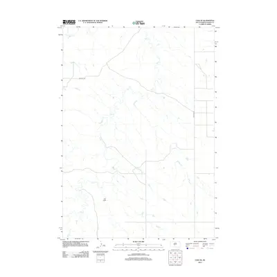
2012 Map of Capa SE
USGS Topo · Published 2012About this map
Bad River meanders across the northwestern corner of this Jones County landscape, defining the local drainage system alongside its significant tributary, Dry Cr. This 2012 survey illustrates the sparse, ranch-oriented layout of the South Dakota plains, where the terrain is marked by geographic features like Ash Draw. Modern transportation relies on the arterial Bad River Rd and Van Metre Rd, which follow the natural contours of the land and provide access to the vast open spaces of the West River region. The map reveals a high-plains environment where water sources and road networks are essential for navigating the expansive, open topography of the area.
Find a feature on this map
5 named features on this map. Tap any name to fly to it.
Don’t see what you’re looking for? This feature index may not catch every label — zoom into the map to look around manually.
Map Details
Editions of this 2012 Capa SE Map
This is the sole edition of this map. No revisions or reprints were ever made.
Other maps of this area

1951 · Capa
USGS Topo · 1:24,000

1951 · Van Metre
USGS Topo · 1:24,000

1951 · Capa NW
USGS Topo · 1:24,000

1951 · Capa SE
USGS Topo · 1:24,000

1953 · Wendte
USGS Topo · 1:24,000

1954 · Pierre
USGS Topo · 1:250,000

1955 · Martin
USGS Topo · 1:250,000

1958 · Pierre
USGS Topo · 1:250,000

1958 · Martin
USGS Topo · 1:250,000

1972 · Murdo
USGS Topo · 1:24,000