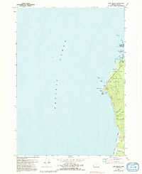
1970 Map of Cape Arago
USGS Topo · Published 1992About this map
Cape Arago State Park and the adjacent Sunset Bay State Park dominate this coastal survey, revealing a landscape defined by dramatic geological formations and early recreational development. The shoreline is punctuated by notable landmarks such as Gregory Point and the Coast Guard Reservation, while offshore, the complex hazards of Simpson Reef and Arago Reef are charted in detail. The inland portion of the map at Shore Acres showcases the Botanical Gardens, indicating the transformation of private estates into public natural assets.
Find a feature on this map
35 named features on this map. Tap any name to fly to it.
Don’t see what you’re looking for? This feature index may not catch every label — zoom into the map to look around manually.
Map Details
Editions of this 1970 Cape Arago Map
2 editions found
Other maps of this area

1896 · Coos Bay
USGS Topo · 1:125,000

1898 · Coos Bay
USGS Topo · 1:125,000

1900 · Coos Bay
USGS Topo · 1:125,000

1942 · Empire
USGS Topo · 1:62,500

1943 · Bandon
USGS Topo · 1:62,500

1944 · Empire
USGS Topo · 1:62,500

1944 · Bandon
USGS Topo · 1:62,500

1954 · Coos Bay
USGS Topo · 1:250,000

1958 · Coos Bay
USGS Topo · 1:250,000

1962 · Coos Bay
USGS Topo · 1:250,000