
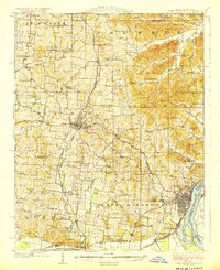
1924 Map of Cape Girardeau
USGS Topo · Published 1924About this map
Cape Girardeau serves as the focal point of this 1920s survey, situated where the St Louis San Francisco Railroad meets the Mississippi River. The landscape reveals a transition from the riverfront bottoms at Rock Levee to the upland terrain of Byrd and Shawnee townships. Local education and community life are densely documented through an extensive network of country schools and churches, including the distinctly named Needmore School, Schoenebeck School, and Pleasant Hill Church.
Find a feature on this map
71 named features on this map. Tap any name to fly to it.
Don’t see what you’re looking for? This feature index may not catch every label — zoom into the map to look around manually.
Map Details
Editions of this 1924 Cape Girardeau Map
2 editions found
Other maps of this area

1918 · Altenburg
USGS Topo · 1:62,500

1920 · Jonesboro
USGS Topo · 1:62,500

1922 · Cape Girardeau
USGS Topo · 1:62,500

1923 · Jonesboro
USGS Topo · 1:62,500

1923 · Perryville
USGS Topo · 1:62,500

1924 · Perryville
USGS Topo · 1:62,500

1924 · Alto Pass
USGS Topo · 1:62,500

1925 · Altenburg
USGS Topo · 1:62,500

1933 · Marble Hill
USGS Topo · 1:62,500

1934 · Thebes
USGS Topo · 1:62,500