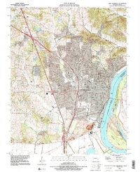
1993 Map of Cape Girardeau
USGS Topo · Published 1995About this map
Cape Girardeau dominates the landscape along the western bank of the Mississippi River, showcasing the city's significant expansion toward the late 20th century. The settlement pattern reflects a blend of institutional growth and preserved history, anchored by the sprawling campus of Southeast Missouri State University and several historic cemeteries like Old Hanover Cem and Fairmont Cem. To the west, the suburban landscape gives way to more varied terrain near Mount Tabor, while the riverfront remains a critical industrial and transport corridor featuring Giboney Island and the expansive Black Land Bottom to the south. This survey, updated with 1993 imagery, traces the city's modern infrastructure including Interchange 99 and Interchange 98, which shaped the residential and commercial development of the Missouri-Illinois borderlands.
Find a feature on this map
44 named features on this map. Tap any name to fly to it.
Don’t see what you’re looking for? This feature index may not catch every label — zoom into the map to look around manually.
Map Details
Editions of this 1993 Cape Girardeau Map
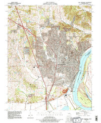
2 editions found
Other maps of this area

1920 · Jonesboro
USGS Topo · 1:62,500

1922 · Cape Girardeau
USGS Topo · 1:62,500

1923 · Jonesboro
USGS Topo · 1:62,500

1924 · Cape Girardeau
USGS Topo · 1:62,500

1934 · Thebes
USGS Topo · 1:62,500

1934 · Morley
USGS Topo · 1:62,500

1939 · Morley
USGS Topo · 1:62,500

1939 · Thebes
USGS Topo · 1:62,500

1947 · Jonesboro
USGS Topo · 1:62,500

1947 · Mc Clure
USGS Topo · 1:24,000