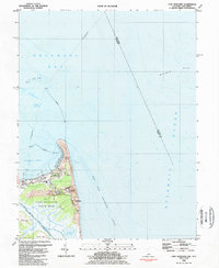
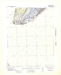
1984 Map of Cape Henlopen
USGS Topo · Published 1984About this map
The maritime gateway where the Delaware Bay meets the Atlantic Ocean is anchored by the shifting sands of Cape Henlopen. This mid-1980s survey details a landscape defined by coastal defense and navigation, featuring a U S Military Reservation and a U S Naval Reservation situated among the dunes of Cape Henlopen State Park. The historic town of Lewes serves as the inland hub, with its corporate boundaries reaching toward the protected waters of Breakwater Harbor.
Find a feature on this map
39 named features on this map. Tap any name to fly to it.
Don’t see what you’re looking for? This feature index may not catch every label — zoom into the map to look around manually.
Map Details
Editions of this 1984 Cape Henlopen Map
4 editions found
Other maps of this area

1888 · Cape May
USGS Topo · 1:62,500

1893 · Cape May
USGS Topo · 1:62,500

1898 · Cape May
USGS Topo · 1:62,500

1918 · Rehoboth
USGS Topo · 1:62,500

1918 · Cape Henlopen
USGS Topo · 1:62,500

1918 · Cape May
USGS Topo · 1:62,500

1925 · Cape May
USGS Topo · 1:62,500

1937 · Cape Henlopen
USGS Topo · 1:62,500

1938 · Rehoboth
USGS Topo · 1:62,500
1940 · Cape May
USGS Topo · 1:62,500