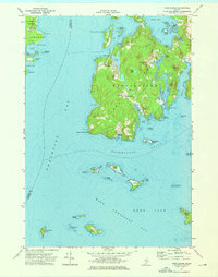
1973 Map of Cape Rosier
USGS Topo · Published 1976About this map
Cape Rosier extends into the waters of East Penobscot Bay, defining a landscape of rocky points and tidal inlets in the early 1970s. The settlement at Harborside and the industrial footprint of a Quarry near Goose Falls reveal a coastline shaped by both local industry and maritime proximity. On the eastern shore, family-named landmarks like John B Mtn and Charles Howard Pt rise above the complex shoreline of Orcutt Harbor.
Find a feature on this map
80 named features on this map. Tap any name to fly to it.
Don’t see what you’re looking for? This feature index may not catch every label — zoom into the map to look around manually.
Map Details
Editions of this 1973 Cape Rosier Map
3 editions found
Other maps of this area

1902 · Castine
USGS Topo · 1:62,500

1904 · Deer Isle
USGS Topo · 1:62,500

1904 · Castine
USGS Topo · 1:62,500

1904 · Bluehill
USGS Topo · 1:62,500

1904 · Vinalhaven
USGS Topo · 1:62,500

1905 · Penobscot Bay
USGS Topo · 1:125,000

1941 · Castine
USGS Topo · 1:62,500

1941 · Vinalhaven
USGS Topo · 1:62,500

1942 · Deer Isle
USGS Topo · 1:62,500
1943 · Castine
USGS Topo · 1:62,500