
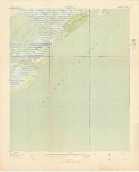
1919 Map of Capers Island
USGS Topo · Published 1919About this map
Capers Island and the surrounding barrier islands of Charleston County appear here in their early twentieth-century state, showing the complex network of tidal waterways and sounds that define this coastal landscape. Surveyed in 1918 by the U.S. Geological Survey in cooperation with the War Department, the map provides a high-resolution view of the shifting shorelines of Dewees Island and the Isle of Palms before modern coastal development.
Find a feature on this map
18 named features on this map. Tap any name to fly to it.
Don’t see what you’re looking for? This feature index may not catch every label — zoom into the map to look around manually.
Map Details
Editions of this 1919 Capers Island Map
2 editions found
Other maps of this area

1919 · The Jetties
USGS Topo · 1:21,120

1919 · Wando
USGS Topo · 1:21,120

1919 · Fort Moultrie
USGS Topo · 1:21,120

1919 · Bulls Island
USGS Topo · 1:21,120

1919 · Sewee Bay
USGS Topo · 1:21,120

1943 · Capers Island
USGS Topo · 1:24,000

1943 · Fort Moultrie
USGS Topo · 1:24,000

1943 · Wando
USGS Topo · 1:24,000

1943 · Sewee Bay
USGS Topo · 1:24,000

1943 · Bulls Island
USGS Topo · 1:24,000