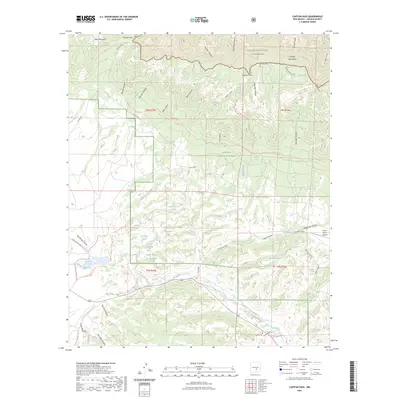
2023 Map of Capitan Pass
USGS Topo · Published 2023About this map
Lincoln National Forest dominates this section of the New Mexico landscape, where the southern slopes of the Capitan Mountains meet a series of canyon-riven valleys. The map documents a sophisticated network of water management and cattle-ranching infrastructure, with numerous catchments like Northwest Tank and Salado Tank scattered throughout the foothills. The high ground is defined by prominent landmarks such as West Mountain and Padilla Point, while the hydrological importance of the region is evident in the many named springs, including Hammett Spring and Peppin Spring. At the lower elevations, the Rio Bonito flows eastward, passing near the Griego Cem and the G Bar F Ranch Airport. This area is also crisscrossed by backcountry routes like the South Base Trl and Thorium Canyon Trl, reflecting the historical and modern utility of the terrain for grazing and recreation.
Find a feature on this map
64 named features on this map. Tap any name to fly to it.
Don’t see what you’re looking for? This feature index may not catch every label — zoom into the map to look around manually.
Map Details
Editions of this 2023 Capitan Pass Map
This is the sole edition of this map. No revisions or reprints were ever made.
Other maps of this area

1934 · Capitan
USGS Topo · 1:48,000

1935 · Capitan Mountains
USGS Topo · 1:48,000

1937 · Capitan
USGS Topo · 1:62,500

1940 · Capitan Mountains
USGS Topo · 1:62,500

1955 · Roswell
USGS Topo · 1:250,000

1958 · Roswell
USGS Topo · 1:250,000

1961 · Lincoln
USGS Topo · 1:62,500

1962 · Roswell
USGS Topo · 1:250,000

1963 · Fort Stanton
USGS Topo · 1:24,000

1973 · Jacob Spring
USGS Topo · 1:24,000