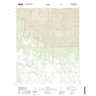
2023 Map of Capitan Peak
USGS Topo · Published 2023About this map
The high ridges of the Capitan Mountains dominate this landscape within the Capitan Mountains Wilderness. The terrain is defined by a series of steep drainages, including Peppin Canyon, East Lucero Canyon, and Peachtree Canyon, which radiate from the peaks. This area of the Lincoln National Forest shows a high density of remote water sources essential for livestock and wildlife, such as Alice Spring, Raton Spring, and Section Twelve Tank.
Find a feature on this map
48 named features on this map. Tap any name to fly to it.
Don’t see what you’re looking for? This feature index may not catch every label — zoom into the map to look around manually.
Map Details
Editions of this 2023 Capitan Peak Map
This is the sole edition of this map. No revisions or reprints were ever made.
Other maps of this area

1935 · Capitan Mountains
USGS Topo · 1:48,000

1936 · Arabela
USGS Topo · 1:48,000

1940 · Capitan Mountains
USGS Topo · 1:62,500

1942 · Arabela
USGS Topo · 1:62,500

1955 · Roswell
USGS Topo · 1:250,000

1958 · Roswell
USGS Topo · 1:250,000

1961 · Lincoln
USGS Topo · 1:62,500

1961 · Tinnie
USGS Topo · 1:62,500

1962 · Roswell
USGS Topo · 1:250,000
1981 · Capitan Pass
USGS Topo · 1:24,000