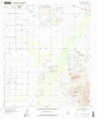
1965 Map of Capitol Dome
USGS Topo · Published 1978About this map
The high peaks of the Florida Mountains dominate the southeastern landscape of this Luna County region, characterized by sharp vertical relief and a history of mineral exploration. Mining activity is evident through the presence of the Stenson Mine and Copper Queen Mine, along with numerous prospects tucked into the crags near Capitol Dome and Dragon Ridge. These features reflect the rugged mining and ranching economy that defined the area during the mid-1960s.
Find a feature on this map
32 named features on this map. Tap any name to fly to it.
Don’t see what you’re looking for? This feature index may not catch every label — zoom into the map to look around manually.
Map Details
Editions of this 1965 Capitol Dome Map
2 editions found
Other maps of this area

1899 · Deming
USGS Topo · 1:125,000

1915 · Deming
USGS Topo · 1:125,000

1955 · Las Cruces
USGS Topo · 1:250,000

1958 · Las Cruces
USGS Topo · 1:250,000

1964 · Gym Peak
USGS Topo · 1:24,000

1964 · Deming West
USGS Topo · 1:24,000

1964 · Florida Gap
USGS Topo · 1:24,000

1965 · South Peak
USGS Topo · 1:24,000

1965 · Deming East
USGS Topo · 1:24,000
1965 · Midway Butte
USGS Topo · 1:24,000