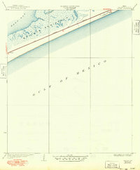
1933 Map of Caplen
USGS Topo · Published 1949About this map
Bolivar Peninsula stretches between the salt waters of the Gulf of Mexico and East Bay, forming a narrow, low-lying coastal barrier in Galveston County. This 1930s coastal landscape is defined by its drainage and transport patterns, with Pasture Bayou and Yates Bayou cutting into the northern shoreline. The map documents the early infrastructure of the region, specifically the Santa Fe and Colorado route which runs parallel to the beach, connecting the small settlements of Patton and Caplen. The presence of these rail and road corridors along the spine of the peninsula illustrates the area's role as a vital link for Gulf Coast transit and local maritime access before significant modern development altered the shoreline.
Find a feature on this map
9 named features on this map. Tap any name to fly to it.
Don’t see what you’re looking for? This feature index may not catch every label — zoom into the map to look around manually.
Map Details
Editions of this 1933 Caplen Map
2 editions found
Other maps of this area

1931 · Flake
USGS Topo · 1:24,000

1931 · High Island
USGS Topo · 1:24,000

1931 · Frozen Point
USGS Topo · 1:24,000

1933 · Frozen Point
USGS Topo · 1:31,680

1933 · Caplen
USGS Topo · 1:31,680

1933 · The Jetties
USGS Topo · 1:31,680

1933 · Whites Lake
USGS Topo · 1:31,680

1933 · Flake
USGS Topo · 1:31,680

1943 · High Island
USGS Topo · 1:31,680
1943 · Flake
USGS Topo · 1:25,000