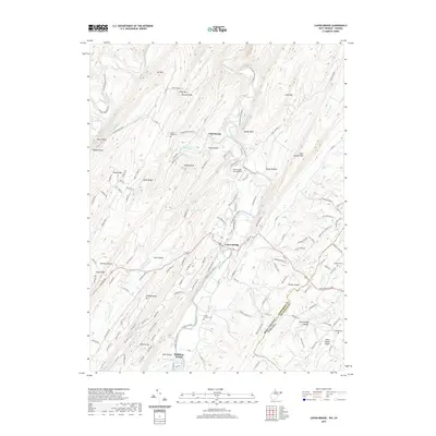
2019 Map of Capon Bridge
USGS Topo · Published 2019About this map
The Cacapon River carves through the central valley of this Appalachian landscape, serving as a primary corridor for the community of Capon Bridge. This 2019 survey captures the settlement patterns of eastern West Virginia as they reach the Virginia state line, highlighting the importance of the Northwestern Pike for regional transit. The topography is defined by parallel ridges such as Ice Mtn, Leith Mtn, and Bear Garden Mtn, which create isolated hollows like Sandy Hollow and Frog Hollow. Local genealogy and land use are well-documented through the presence of several established burial grounds, including the Capon Chapel Cem and Sandy Ridge Cem. Natural water sources are prolific throughout the ridges, noted by landmarks like Bubbling Spring, Buffalo Gap Spring, and Ice Mountain Spring. Small settlements like Cold Stream and Timber Ridge remain connected by a network of winding county roads.
Find a feature on this map
144 named features on this map. Tap any name to fly to it.
Don’t see what you’re looking for? This feature index may not catch every label — zoom into the map to look around manually.
Map Details
Editions of this 2019 Capon Bridge Map
This is the sole edition of this map. No revisions or reprints were ever made.
Other maps of this area

1891 · Romney
USGS Topo · 1:125,000

1894 · Winchester
USGS Topo · 1:125,000

1916 · Capon Bridge
USGS Topo · 1:62,500

1921 · Hanging Rock
USGS Topo · 1:48,000

1922 · Wardensville
USGS Topo · 1:62,500

1923 · Middletown
USGS Topo · 1:62,500

1923 · Capon Bridge
USGS Topo · 1:62,500

1923 · Hanging Rock
USGS Topo · 1:62,500

1924 · Wardensville
USGS Topo · 1:62,500

1937 · Capon Bridge
USGS Topo · 1:48,000