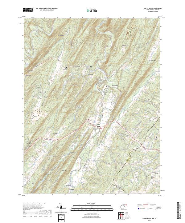
2023 Map of Capon Bridge
USGS Topo · Published 2023About this map
The Cacapon River carves a deep valley through this portion of Hampshire County, anchoring the settlement of Capon Bridge. The landscape is defined by long, parallel ridges like Sandy Ridge and Timber Ridge, which dictate the local road network and agricultural patterns. Significant for genealogical research, several historic burial grounds are noted, including Capon Chapel Cem and Fairview Lutheran Church Cem. Natural springs are a prominent feature of this geography, with Ice Mountain Spring, Hiett Spring, and Bubbling Spring emerging from the base of the mountains. This area reflects a traditional Appalachian mountain economy, where small settlements like Cold Stream and Pleasant Grove are connected by narrow winding roads such as Springfield Grade Rd and Dillons Run Rd. The terrain is particularly complex near Ice Mountain and Schaffenaker Mountain, where steep hollows like Kale Hollow and Stonebridge Hollow separate the high peaks from the river bottomlands.
Find a feature on this map
149 named features on this map. Tap any name to fly to it.
Don’t see what you’re looking for? This feature index may not catch every label — zoom into the map to look around manually.
Map Details
Editions of this 2023 Capon Bridge Map
This is the sole edition of this map. No revisions or reprints were ever made.
Other maps of this area

1891 · Romney
USGS Topo · 1:125,000

1894 · Winchester
USGS Topo · 1:125,000

1916 · Capon Bridge
USGS Topo · 1:62,500

1921 · Hanging Rock
USGS Topo · 1:48,000

1922 · Wardensville
USGS Topo · 1:62,500

1923 · Middletown
USGS Topo · 1:62,500

1923 · Capon Bridge
USGS Topo · 1:62,500

1923 · Hanging Rock
USGS Topo · 1:62,500

1924 · Wardensville
USGS Topo · 1:62,500

1937 · Capon Bridge
USGS Topo · 1:48,000