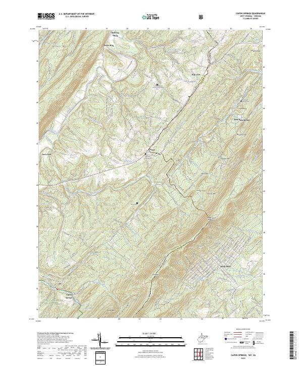
2023 Map of Capon Springs
USGS Topo · Published 2023About this map
Great North Mountain and the West Virginia-Virginia state line dominate this survey of Hampshire and Frederick counties. The landscape is defined by the northeast-southwest orientation of its ridges, including Timber Ridge, Fall Ridge, and Pinnacle Ridge. Settlements like Lehew, High View, and Hooks Mills are connected by winding mountain roads such as Carpers Pike. The map provides detailed locations for local genealogy, marking the Timber Ridge Christian Church Cem, Shiloh United Methodist Church Cem, and the remote Racey Cem. The southern portion contains the George Washington National Forest and the namesake Capon Springs, where the terrain drops into Big Hollow. Along the eastern border, the residential development at Wilde Acres sits near Pifer Run and the Tunnel Ridge gap.
Find a feature on this map
161 named features on this map. Tap any name to fly to it.
Don’t see what you’re looking for? This feature index may not catch every label — zoom into the map to look around manually.
Map Details
Editions of this 2023 Capon Springs Map
This is the sole edition of this map. No revisions or reprints were ever made.
Other maps of this area

1891 · Romney
USGS Topo · 1:125,000

1894 · Winchester
USGS Topo · 1:125,000

1916 · Capon Bridge
USGS Topo · 1:62,500

1921 · Hanging Rock
USGS Topo · 1:48,000

1922 · Wardensville
USGS Topo · 1:62,500

1923 · Middletown
USGS Topo · 1:62,500

1923 · Capon Bridge
USGS Topo · 1:62,500

1923 · Hanging Rock
USGS Topo · 1:62,500

1924 · Wardensville
USGS Topo · 1:62,500

1937 · Capon Bridge
USGS Topo · 1:48,000