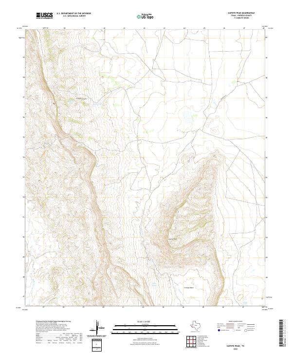
2022 Map of Capote Peak
USGS Topo · Published 2022About this map
Capote Peak dominates this high-elevation landscape in Presidio County, standing as a prominent landmark above the surrounding high desert terrain. The map details a rugged drainage system characterized by Capote Cr and Walker Cr, which carve through the arid surface toward the Cienega Basin. This area reflects a long history of cattle ranching and land management in the Big Bend region, evidenced by the presence of water resources like Hoya Tank, Cruz Tank, and the vital Capote Springs. Human passage through this difficult geography is marked by the Pack Trl and the winding Old Brite Rd, routes that likely served as essential connections between remote ranching outposts. Further north, Trough Canyon and its associated Trough Canyon Spring provide additional evidence of how water dictated movement and settlement in this corner of West Texas.
Find a feature on this map
11 named features on this map. Tap any name to fly to it.
Don’t see what you’re looking for? This feature index may not catch every label — zoom into the map to look around manually.
Map Details
Editions of this 2022 Capote Peak Map
This is the sole edition of this map. No revisions or reprints were ever made.
Other maps of this area

1895 · Marfa
USGS Topo · 1:125,000

1896 · San Carlos
USGS Topo · 1:125,000

1959 · Marfa
USGS Topo · 1:250,000

1965 · Marfa
USGS Topo · 1:250,000
1978 · Gettysburg Peak
USGS Topo · 1:24,000
1978 · Capote Peak
USGS Topo · 1:24,000
1979 · Nancy Anne Ranch
USGS Topo · 1:24,000

1979 · Capote Falls
USGS Topo · 1:24,000
1979 · Candelaria
USGS Topo · 1:24,000
1979 · McComb Canyon
USGS Topo · 1:24,000