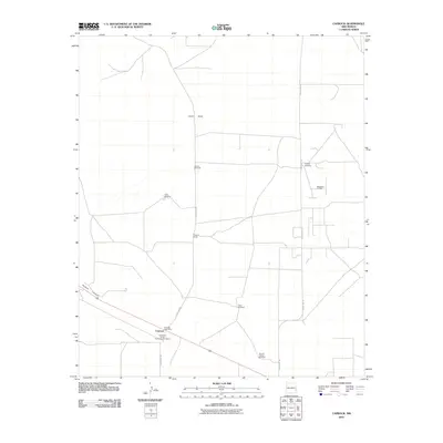
2010 Map of Caprock
USGS Topo · Published 2010About this map
The Caprock Post Office serves as the focal point for this high-plains landscape, where the flat terrain of the Llano Estacado meets the cultural history of the Mescalero Sands Archaeological District. This region is defined by its deep reliance on water infrastructure and petroleum extraction, evidenced by the numerous named water sources scattered across the range, including the Section Windmill, Field Windmill, and Church Pasture Windmill. The industrial footprint of the Mescalero Oil Field contrasts with the natural topography of Polecat Canyon, which cuts through the southwestern portion of the map. A network of rural routes, such as Hedgecoke Rd and County Rd-156, connects remote ranching operations like the Caprock Ranch to the primary settlements, illustrating the sparse but vital transport system of this arid environment.
Find a feature on this map
16 named features on this map. Tap any name to fly to it.
Don’t see what you’re looking for? This feature index may not catch every label — zoom into the map to look around manually.
Map Details
Editions of this 2010 Caprock Map
This is the sole edition of this map. No revisions or reprints were ever made.
Other maps of this area

1954 · Brownfield
USGS Topo · 1:250,000

1958 · Brownfield
USGS Topo · 1:250,000

1962 · Brownfield
USGS Topo · 1:250,000
1973 · Mescalero Point
USGS Topo · 1:24,000
1973 · Soldier Hill
USGS Topo · 1:24,000
1973 · Caprock
USGS Topo · 1:24,000
1973 · Mescalero Point NE
USGS Topo · 1:24,000
1973 · Lane Salt Lake
USGS Topo · 1:24,000
1973 · Dallas Store
USGS Topo · 1:24,000
1978 · Flying M Ranch
USGS Topo · 1:24,000