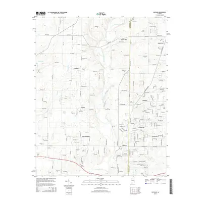
2014 Map of Capshaw
USGS Topo · Published 2014About this map
Limestone Creek and its many tributaries, including Leslie Br and Kaufman Br, define the drainage patterns of this border region between Limestone and Madison counties. The landscape is characterized by a dense network of family-named cemeteries and small settlements like Fairview and East Limestone, reflecting a deeply rooted rural community structure. Notable historical markers of local life include Fairview Church Cem, Wesley Chapel Cem, and Nick Davis Cem. The presence of Old Railroad Bed Rd suggests a transit history that predates the modern road network, while features like Nelson Spring and Harding Spring point to the area's natural water resources. Significant residential growth is evident in the cluster of names like French Hill, Northwood, and Clarkdale, contrasting with the more dispersed rural holdings to the west around Copeland.
Find a feature on this map
196 named features on this map. Tap any name to fly to it.
Don’t see what you’re looking for? This feature index may not catch every label — zoom into the map to look around manually.
Map Details
Editions of this 2014 Capshaw Map
This is the sole edition of this map. No revisions or reprints were ever made.
Other maps of this area

1888 · Huntsville
USGS Topo · 1:125,000

1892 · Huntsville
USGS Topo · 1:125,000

1935 · Athens
USGS Topo · 1:24,000

1936 · Jeff
USGS Topo · 1:24,000

1936 · Capshaw
USGS Topo · 1:24,000

1936 · Madison
USGS Topo · 1:24,000

1936 · Elkmont
USGS Topo · 1:24,000

1936 · Ardmore
USGS Topo · 1:24,000

1936 · Toney
USGS Topo · 1:24,000

1936 · Tanner
USGS Topo · 1:24,000