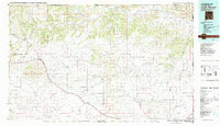
1982 Map of Capulin Mountain
USGS Topo · Published 1982About this map
Capulin Mountain National Monument dominates the western landscape of this Northeastern New Mexico survey, where volcanic features like Baby Capulin and Mud Hill rise above the high plains. The map details a transition from the volcanic peaks to the wide mesas and canyon lands of Union County, where the Dry Cimarron River carves through the northern breaks. The settlement pattern follows the Colorado and Southern railroad line, linking towns such as Folsom, Des Moines, and Mount Dora along a vital transport corridor that parallels historical routes.
Find a feature on this map
57 named features on this map. Tap any name to fly to it.
Don’t see what you’re looking for? This feature index may not catch every label — zoom into the map to look around manually.
Map Details
Editions of this 1982 Capulin Mountain Map
2 editions found
Other maps of this area

1891 · Springfield
USGS Topo · 1:125,000

1891 · Mesa De Maya
USGS Topo · 1:125,000

1892 · Elmoro
USGS Topo · 1:125,000

1892 · Mt Carrizo
USGS Topo · 1:125,000

1893 · Elmoro
USGS Topo · 1:125,000

1893 · Springfield
USGS Topo · 1:125,000

1893 · Mesa de Maya
USGS Topo · 1:125,000

1897 · Elmoro
USGS Topo · 1:125,000

1954 · Raton
USGS Topo · 1:250,000

1954 · Trinidad
USGS Topo · 1:250,000