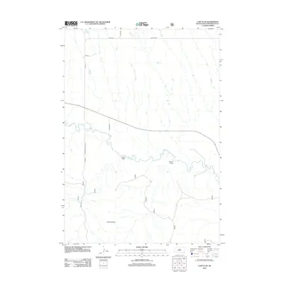
2012 Map of Caputa NE
USGS Topo · Published 2012About this map
Rapid Cr carves a winding path through this portion of Pennington County, defining the local hydrology alongside ephemeral watercourses like Bear Run. The landscape is dominated by significant topographical markers, most notably the Railroad Buttes in the south and the etched drainage patterns of Lindsey Draw and Elkhorn Draw. This area represents a characteristic rural South Dakota landscape where the transition from high plains to creek bottomlands is managed by a structured grid of section-line roads, including Base Line Rd and 161st Ave. Transportation routes such as Farmingdale-Folsom Rd and Penn C491 connect these remote ranchlands, providing a clear view of the region's agricultural and geographic layout as it existed in the early 21st century.
Find a feature on this map
12 named features on this map. Tap any name to fly to it.
Don’t see what you’re looking for? This feature index may not catch every label — zoom into the map to look around manually.
Map Details
Editions of this 2012 Caputa NE Map
This is the sole edition of this map. No revisions or reprints were ever made.
Other maps of this area

1953 · New Underwood
USGS Topo · 1:24,000

1953 · New Underwood SW
USGS Topo · 1:24,000

1953 · Caputa
USGS Topo · 1:24,000

1953 · Folsom
USGS Topo · 1:24,000

1953 · Caputa NE
USGS Topo · 1:24,000

1953 · Rapid City
USGS Topo · 1:250,000

1953 · Caputa SW
USGS Topo · 1:24,000

1954 · Creston
USGS Topo · 1:24,000

1954 · Scenic SW
USGS Topo · 1:24,000

1955 · Hot Springs
USGS Topo · 1:250,000