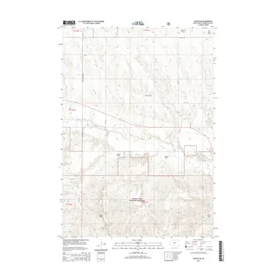
2015 Map of Caputa NE
USGS Topo · Published 2015About this map
Buffalo Gap National Grassland dominates the southern portion of this landscape, where the elevation drops into a series of complex drainages. The topography is defined by numerous draws, including Swinehart Draw and Van Lone Draw in the north, which channel water toward the central course of Rapid Creek. This waterway serves as the primary hydrological feature, winding through the center of the sheet and influencing the placement of local roads such as Farmingdale-Folsom Rd.
Find a feature on this map
23 named features on this map. Tap any name to fly to it.
Don’t see what you’re looking for? This feature index may not catch every label — zoom into the map to look around manually.
Map Details
Editions of this 2015 Caputa NE Map
This is the sole edition of this map. No revisions or reprints were ever made.
Other maps of this area

1953 · New Underwood
USGS Topo · 1:24,000

1953 · New Underwood SW
USGS Topo · 1:24,000

1953 · Caputa
USGS Topo · 1:24,000

1953 · Folsom
USGS Topo · 1:24,000

1953 · Caputa NE
USGS Topo · 1:24,000

1953 · Rapid City
USGS Topo · 1:250,000

1953 · Caputa SW
USGS Topo · 1:24,000

1954 · Creston
USGS Topo · 1:24,000

1954 · Scenic SW
USGS Topo · 1:24,000

1955 · Hot Springs
USGS Topo · 1:250,000