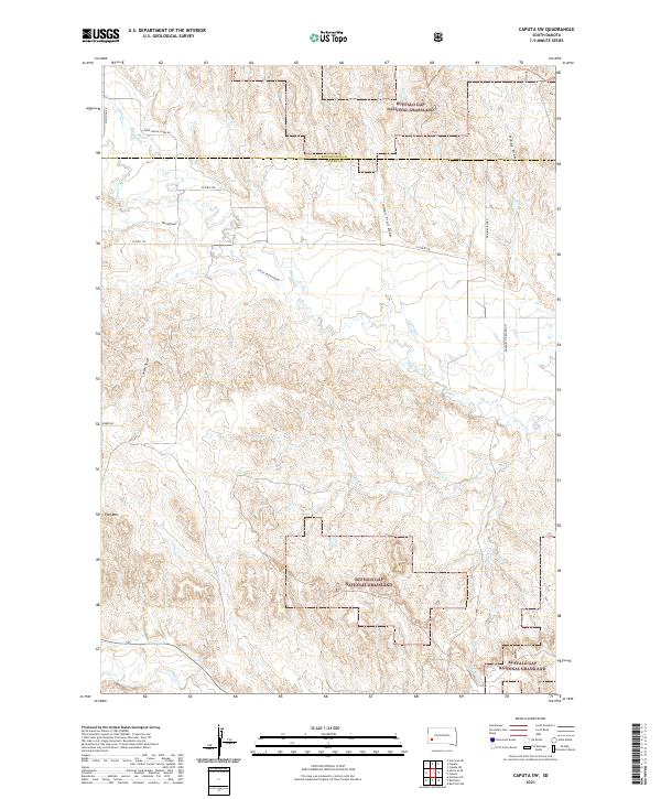
2021 Map of Caputa SW
USGS Topo · Published 2021About this map
The Buffalo Gap National Grassland dominates this portion of the Black Hills region, where the high plains transition into topographical features like Flag Mtn. The landscape is defined by a dense network of drainage patterns, specifically the numerous named draws and gulches that channel water through the arid terrain. School Section Draw, Indian Trail Draw, and Lauzon Gulch reflect the historical land-use and movement patterns across the border of Pennington and Custer counties. The hydrology is anchored by Spring Cr and Battle Cr, which are joined by seasonal watercourses like Dry Cr and Willow Cr. Remote access is maintained through a grid of rural roads including McMahon Rd and Lower Spring Creek Rd, which navigate the elevation changes between the draws.
Find a feature on this map
22 named features on this map. Tap any name to fly to it.
Don’t see what you’re looking for? This feature index may not catch every label — zoom into the map to look around manually.
Map Details
Editions of this 2021 Caputa SW Map
This is the sole edition of this map. No revisions or reprints were ever made.
Other maps of this area

1894 · Hermosa
USGS Topo · 1:125,000

1901 · Hermosa
USGS Topo · 1:125,000

1951 · Red Shirt
USGS Topo · 1:24,000

1951 · Red Shirt NE
USGS Topo · 1:24,000

1953 · Caputa
USGS Topo · 1:24,000

1953 · Hermosa SE
USGS Topo · 1:24,000

1953 · Folsom
USGS Topo · 1:24,000
1953 · Hermosa NE
USGS Topo · 1:24,000

1953 · Caputa NE
USGS Topo · 1:24,000

1953 · Caputa SW
USGS Topo · 1:24,000