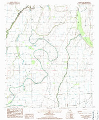
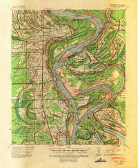
1986 Map of Caraway Lake
USGS Topo · Published 1987About this map
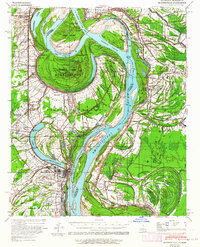
Joes Bayou meanders through the alluvial bottomlands of the Mississippi Delta, anchoring a landscape defined by an intricate network of secondary waterways and drainage systems. This mid-1980s survey captures the agricultural character of the region, where numerous oxbow lakes such as Caraway Lake and Long Lake reveal the historic migration of the river system. The map documents the extensive hydrological management of the era, visible in the straight lines of Ditch No 9 and Ditch No 1, which serve to drain the low-lying terrain between Tensas Bayou and Bayou Macon.
Find a feature on this map
17 named features on this map. Tap any name to fly to it.
Don’t see what you’re looking for? This feature index may not catch every label — zoom into the map to look around manually.
Map Details
Editions of this 1986 Caraway Lake Map
This is the sole edition of this map. No revisions or reprints were ever made.
Other maps of this area

1909 · Baxter Bayou
USGS Topo · 1:24,000
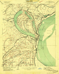
1909 · Lake Providence
USGS Topo · 1:24,000
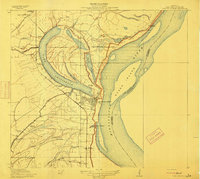
1911 · Lake Providence
USGS Topo · 1:31,680

1911 · Baxter Bayou
USGS Topo · 1:24,000

1914 · Baxter Bayou
USGS Topo · 1:31,680
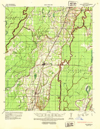
1935 · Oak Grove
USGS Topo · 1:62,500
1939 · Alsatia
USGS Topo · 1:62,500
1939 · Mayersville
USGS Topo · 1:62,500

1955 · Jackson
USGS Topo · 1:250,000
1958 · Oak Grove
USGS Topo · 1:62,500