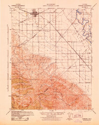
1942 Map of Carbona
USGS Topo · Published 1942About this map
The growing railroad hub of Tracy anchors this 1942 survey, where the Southern Pacific and Western Pacific lines converge. The landscape transitions from the flat, irrigated fields of the Central Valley into the complex ridges of the Diablo Range to the south. Notable for local historians, the map identifies several rural educational landmarks including Jefferson School, New Jerusalem School, and Rising Sun School. Along the western edge, the Tesla Branch railroad line winds toward the foothills, serving the industry near Black Butte.
Find a feature on this map
49 named features on this map. Tap any name to fly to it.
Don’t see what you’re looking for? This feature index may not catch every label — zoom into the map to look around manually.
Map Details
Editions of this 1942 Carbona Map
This is the sole edition of this map. No revisions or reprints were ever made.
Other maps of this area

1897 · Mt. Hamilton
USGS Topo · 1:62,500

1907 · Tesla
USGS Topo · 1:62,500

1913 · Romain
USGS Topo · 1:31,680

1914 · Manteca
USGS Topo · 1:31,680

1914 · Bethany
USGS Topo · 1:31,680

1914 · Union Island
USGS Topo · 1:31,680

1915 · Vernalis
USGS Topo · 1:31,680

1915 · Lathrop
USGS Topo · 1:31,680

1915 · Ripon
USGS Topo · 1:31,680

1915 · Westley
USGS Topo · 1:31,680