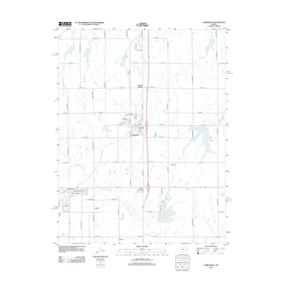
2012 Map of Carbondale
USGS Topo · Published 2012About this map
Carbondale and Scranton serve as the primary hubs in this part of Osage County, where the grid of rural roads meets significant water features and local landmarks. The landscape is defined by the winding paths of Hundred and Ten Mile Cr and Burys Cr, leading toward the substantial Osage County Lake in the southeast. This 2012 survey illustrates the transition from traditional agriculture to modern municipal infrastructure, noted by the Carbondale Wastewater Facility and distinct water towers in both major settlements.
Find a feature on this map
70 named features on this map. Tap any name to fly to it.
Don’t see what you’re looking for? This feature index may not catch every label — zoom into the map to look around manually.
Map Details
Editions of this 2012 Carbondale Map
This is the sole edition of this map. No revisions or reprints were ever made.
Other maps of this area

1889 · Burlingame
USGS Topo · 1:125,000

1894 · Burlingame
USGS Topo · 1:125,000

1947 · Lawrence
USGS Topo · 1:250,000

1950 · Lawrence
USGS Topo · 1:250,000

1952 · Auburn
USGS Topo · 1:24,000

1952 · Burlingame
USGS Topo · 1:24,000
1955 · Wakarusa
USGS Topo · 1:24,000

1955 · Overbrook
USGS Topo · 1:24,000

1955 · Carbondale
USGS Topo · 1:24,000
1955 · Richland
USGS Topo · 1:24,000