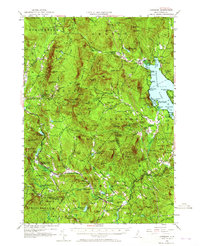
1956 Map of Cardigan
USGS Topo · Published 1965About this map
Mt Cardigan serves as the focal point of this New Hampshire landscape, where the Appalachian Mtn Trail and several local paths like the Manning Trail and Holt Trail converge on its slopes. The topography is defined by the sharp transition from the granite peaks of the Cardigan range to the waters of Newfound Lake in the east. Settlement patterns reflect the 1950s rural economy, with clusters at Grafton Center and Hebron, while the presence of a Lookout Tower and Wellington State Park indicates the growing importance of conservation and recreation in the region. Resource extraction remains visible through several features including a Mica Mine (Inactive) and a Garnet Mine (Inactive). The rail infrastructure is represented by the Grafton Sta, connecting these remote upland communities and industrial sites to the wider corridor through the Smith River valley.
Find a feature on this map
146 named features on this map. Tap any name to fly to it.
Don’t see what you’re looking for? This feature index may not catch every label — zoom into the map to look around manually.
Map Details
Editions of this 1956 Cardigan Map
3 editions found

Other maps of this area

1902 · Sunapee
USGS Topo · 1:62,500

1905 · Sunapee
USGS Topo · 1:62,500

1907 · Sunapee
USGS Topo · 1:62,500

1925 · Holderness
USGS Topo · 1:62,500

1927 · Penacook
USGS Topo · 1:62,500

1927 · Holderness
USGS Topo · 1:62,500

1927 · Cardigan
USGS Topo · 1:62,500

1927 · Mascoma
USGS Topo · 1:62,500

1928 · Mount Kearsarge
USGS Topo · 1:62,500

1928 · Plymouth
USGS Topo · 1:62,500