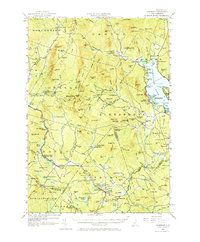
1956 Map of Cardigan
USGS Topo · Published 1973About this map
The granite peaks of Mt Cardigan and Firescrew dominate this mid-century survey of the New Hampshire interior. The landscape reflects a mix of rugged high-elevation terrain and small, valley-bound settlements. To the east, the waters of Newfound Lake are bordered by Wellington State Park and the developed shorelines of Hebron Bay and Pasquaney Bay. Local industry and connectivity are evident through the Boston and Maine railroad line, which passes through Grafton Center and the now-inactive extraction sites like the Mica Mine and Garnet Mine. This era shows a community defined by its natural resources, with scattered schoolhouses such as School No 9 and Elmwood Sch serving the rural reaches of Alexandria and Groton. Detailed labels identify family-named landmarks like Bucks Corner and Robinson Corner, alongside numerous ponds including Kilton Pond and Waukeena Lake.
Find a feature on this map
155 named features on this map. Tap any name to fly to it.
Don’t see what you’re looking for? This feature index may not catch every label — zoom into the map to look around manually.
Map Details
Editions of this 1956 Cardigan Map
3 editions found

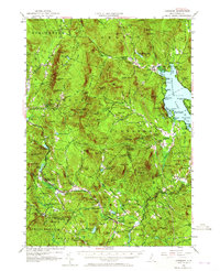
Other maps of this area

1902 · Sunapee
USGS Topo · 1:62,500

1905 · Sunapee
USGS Topo · 1:62,500

1907 · Sunapee
USGS Topo · 1:62,500

1925 · Holderness
USGS Topo · 1:62,500

1927 · Penacook
USGS Topo · 1:62,500

1927 · Holderness
USGS Topo · 1:62,500

1927 · Cardigan
USGS Topo · 1:62,500

1927 · Mascoma
USGS Topo · 1:62,500

1928 · Mount Kearsarge
USGS Topo · 1:62,500

1928 · Plymouth
USGS Topo · 1:62,500