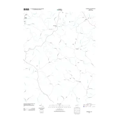
2013 Map of Cardwell
USGS Topo · Published 2013About this map
Tatham Springs and the winding Chaplin River define this rural landscape of Washington County, Kentucky, in the early 21st century. The map reveals a deeply etched drainage pattern where numerous named creeks like Glens Cr, Danbow Cr, and Three Lick Cr have carved the terrain. Settlement remains concentrated in small communities such as Sharpsville, Cardwell, and Battle, which are connected by a web of narrow ridge roads and hollow lanes. For genealogists, the map is particularly detailed, recording more than a dozen family and community burial grounds including Sea Cem, Masters Cem, and Perkins Cem. The placement of these cemeteries often corresponds with former homesteads and early church sites, providing a spatial record of local family lineages in this section of the Bluegrass region.
Find a feature on this map
92 named features on this map. Tap any name to fly to it.
Don’t see what you’re looking for? This feature index may not catch every label — zoom into the map to look around manually.
Map Details
Editions of this 2013 Cardwell Map
This is the sole edition of this map. No revisions or reprints were ever made.
Other maps of this area

1905 · Harrodsburg
USGS Topo · 1:125,000

1952 · Perryville
USGS Topo · 1:24,000

1952 · Cornishville
USGS Topo · 1:24,000

1952 · Ashbrook
USGS Topo · 1:24,000

1952 · Chaplin
USGS Topo · 1:24,000

1952 · Mc Brayer
USGS Topo · 1:24,000

1953 · Mackville
USGS Topo · 1:24,000

1953 · Brush Grove
USGS Topo · 1:24,000

1953 · Cardwell
USGS Topo · 1:24,000

1953 · Springfield
USGS Topo · 1:24,000