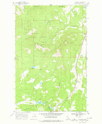
1968 Map of Careywood
USGS Topo · Published 1978About this map
The Northern Pacific railroad corridor dictates the settlement pattern of this Bonner County landscape during the late 1960s, threading through the valleys between Long Mountain and Huckleberry Mountain. Small railway-oriented communities like Cocolalla, Careywood, and Granite line the tracks, which parallel the course of Cocolalla Creek. Much of the territory is defined by the Kaniksu National Forest, where a network of trails and a Lookout Tower overlook the timbered slopes. In the lower elevations, a string of glacial water bodies including Cocolalla Lake, Lambertson Lake, Beaver Lake, and Kelso Lake break up the forest cover. An old RR grade and a prominent Pipeline reflect the evolving transportation and energy infrastructure serving this Idaho panhandle region.
Find a feature on this map
30 named features on this map. Tap any name to fly to it.
Don’t see what you’re looking for? This feature index may not catch every label — zoom into the map to look around manually.
Map Details
Editions of this 1968 Careywood Map
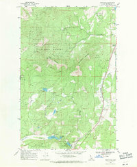
2 editions found
Other maps of this area

1901 · Sandpoint
USGS Topo · 1:125,000

1903 · Rathdrum
USGS Topo · 1:125,000

1911 · Priest Lake
USGS Topo · 1:250,000

1911 · Sandpoint
USGS Topo · 1:125,000

1913 · Priest Lake
USGS Topo · 1:250,000

1955 · Spokane
USGS Topo · 1:250,000

1958 · Spokane
USGS Topo · 1:250,000

1958 · Sandpoint
USGS Topo · 1:250,000

1961 · Bayview
USGS Topo · 1:24,000

1961 · Spirit Lake East
USGS Topo · 1:24,000