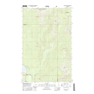
2017 Map of Caribou Creek
USGS Topo · Published 2017About this map
Upper Priest Lake and its connecting waterway, The Thorofare, anchor the southwestern corner of this landscape within the Kaniksu National Forest. The terrain is defined by high alpine ridges and numerous small glacial basins, including Mollies Lake, Caribou Lakes, and W Fork Lake. Long-distance transit is represented by the Pacific NW National Scenic Trail, which winds through the drainage of Caribou Creek and past the western face of Lookout Mtn.
Find a feature on this map
32 named features on this map. Tap any name to fly to it.
Don’t see what you’re looking for? This feature index may not catch every label — zoom into the map to look around manually.
Map Details
Editions of this 2017 Caribou Creek Map
This is the sole edition of this map. No revisions or reprints were ever made.
Other maps of this area

1911 · Priest Lake
USGS Topo · 1:250,000

1913 · Priest Lake
USGS Topo · 1:250,000

1958 · Sandpoint
USGS Topo · 1:250,000

1963 · Sandpoint
USGS Topo · 1:250,000

1967 · Priest Lake NE
USGS Topo · 1:24,000

1967 · Priest Lake NW
USGS Topo · 1:24,000

1967 · The Wigwams
USGS Topo · 1:24,000
1968 · Continental Mtn
USGS Topo · 1:24,000

1969 · Grass Mountain
USGS Topo · 1:24,000
1969 · Caribou Creek
USGS Topo · 1:24,000