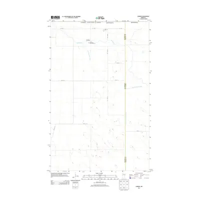
2013 Map of Caribou
USGS Topo · Published 2013About this map
Caribou sits directly along the international boundary between Canada and the United States in this northern Minnesota survey. The landscape is defined by the winding path of the Roseau River and an extensive network of engineered waterways, including State Ditch Number Fiftyone and Judicial Ditch Number Thirtythree, which reflect long-standing efforts to manage the low-lying terrain of the Red River Valley region. For genealogists, the map identifies local burial sites such as Saint John's Cem and the Saint Michaels Greek Orthodox Cem, providing physical markers for the area's diverse early settlement history. This frontier topography is largely divided by a grid of rural roads, including County Road 53 and numerous township highways like Twp Hwy T-295, which connect isolated farmsteads across the Kittson and Roseau county line.
Find a feature on this map
20 named features on this map. Tap any name to fly to it.
Don’t see what you’re looking for? This feature index may not catch every label — zoom into the map to look around manually.
Map Details
Editions of this 2013 Caribou Map
This is the sole edition of this map. No revisions or reprints were ever made.
Other maps of this area

1918 · Hemmington
USGS Topo · 1:62,500

1930 · Juneberry
USGS Topo · 1:31,680

1932 · Juneberry
USGS Topo · 1:62,500

1952 · Thief River Falls
USGS Topo · 1:250,000

1956 · Thief River Falls
USGS Topo · 1:250,000

1957 · Thief River Falls
USGS Topo · 1:250,000

1966 · Caribou
USGS Topo · 1:24,000

1966 · Skull Lake NE
USGS Topo · 1:24,000

1966 · Skull Lake SE
USGS Topo · 1:24,000
1966 · Juneberry Ridge
USGS Topo · 1:24,000