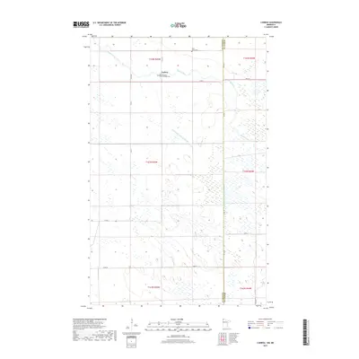
2019 Map of Caribou
USGS Topo · Published 2019About this map
Caribou sits at the northern edge of Minnesota, just south of the international border in this 2019 survey. The landscape is defined by the winding course of the Roseau River, which cuts across the northern half of the map before turning north. This region exhibits a complex drainage system, evidenced by major engineering projects like State Ditch Number Fiftyone and Judicial Ditch Number Thirtythree, which manage the low-lying terrain. For those tracing local heritage, the map identifies significant religious and burial sites, including Saint John's Cem and the Saint Michaels Greek Orthodox Cem, reflecting the cultural history of this rural borderland. The boundary between Kittson County and Roseau County bisects the area, marked by a straight north-south line that intersects the river's path.
Find a feature on this map
25 named features on this map. Tap any name to fly to it.
Don’t see what you’re looking for? This feature index may not catch every label — zoom into the map to look around manually.
Map Details
Editions of this 2019 Caribou Map
This is the sole edition of this map. No revisions or reprints were ever made.
Other maps of this area

1918 · Hemmington
USGS Topo · 1:62,500

1930 · Juneberry
USGS Topo · 1:31,680

1932 · Juneberry
USGS Topo · 1:62,500

1952 · Thief River Falls
USGS Topo · 1:250,000

1956 · Thief River Falls
USGS Topo · 1:250,000

1957 · Thief River Falls
USGS Topo · 1:250,000

1966 · Caribou
USGS Topo · 1:24,000

1966 · Skull Lake NE
USGS Topo · 1:24,000

1966 · Skull Lake SE
USGS Topo · 1:24,000
1966 · Juneberry Ridge
USGS Topo · 1:24,000