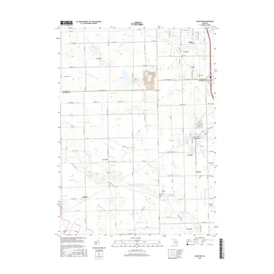
2017 Map of Carleton
USGS Topo · Published 2017About this map
Carleton and the surrounding townships of Monroe and Wayne Counties are defined by an intricate network of agricultural drainage and small rural settlements. This 2017 survey shows the transition from the cluster at Waltz to the larger village of Carleton, which remains a focal point of local commerce and community life. The landscape is etched with historical drainage features like Carroll Drain, Mosquito Drain, and Hamilton Drain, reflecting the extensive land reclamation required for farming this part of Michigan. Genealogists will find a high density of small burial grounds, including Saint Patricks Cem, Felt Cem, and Clark Cem. The area maintains its rural-industrial character near the Buzzwick Airport and along the various rail and road corridors that connect these agrarian communities between the larger hubs of the region.
Find a feature on this map
156 named features on this map. Tap any name to fly to it.
Don’t see what you’re looking for? This feature index may not catch every label — zoom into the map to look around manually.
Map Details
Editions of this 2017 Carleton Map
This is the sole edition of this map. No revisions or reprints were ever made.
Other maps of this area

1902 · Ypsilanti
USGS Topo · 1:62,500

1904 · Ann Arbor
USGS Topo · 1:125,000

1906 · Ypsilanti
USGS Topo · 1:62,500

1906 · Romulus
USGS Topo · 1:62,500

1908 · Ann Arbor
USGS Topo · 1:125,000

1912 · Monroe
USGS Topo · 1:62,500

1912 · Dundee
USGS Topo · 1:62,500

1914 · Monroe
USGS Topo · 1:62,500

1926 · Dundee
USGS Topo · 1:62,500

1927 · Monroe
USGS Topo · 1:31,680
Featured Places
- Frenchtown Charter Township, MI
- Huron Charter Township, MI
- Sumpter Township, MI
- Ash Township, MI
- Raisinville Township, MI