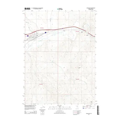
2014 Map of Carlin East
USGS Topo · Published 2014About this map
The Humboldt River corridor dominates this high-desert landscape, serving as the primary artery for both transportation and settlement. The town of Carlin is the central hub, with its street grid including names like School St and Railroad St reflecting the community's civic and industrial foundations. To the west of the town center lies the Carlin Cemetery, while the small sidings or settlements of Vivian and Tonka sit further east along the river's winding path through the Carlin Canyon.
Find a feature on this map
31 named features on this map. Tap any name to fly to it.
Don’t see what you’re looking for? This feature index may not catch every label — zoom into the map to look around manually.
Map Details
Editions of this 2014 Carlin East Map
This is the sole edition of this map. No revisions or reprints were ever made.
Other maps of this area

1952 · Dixie Flats
USGS Topo · 1:62,500

1952 · Carlin
USGS Topo · 1:62,500

1955 · Winnemucca
USGS Topo · 1:250,000

1955 · Elko
USGS Topo · 1:250,000

1958 · Winnemucca
USGS Topo · 1:250,000

1958 · Elko
USGS Topo · 1:250,000

1958 · Hunter
USGS Topo · 1:24,000

1958 · Huntsman Ranch
USGS Topo · 1:24,000

1962 · Elko
USGS Topo · 1:250,000

1962 · Winnemucca
USGS Topo · 1:250,000