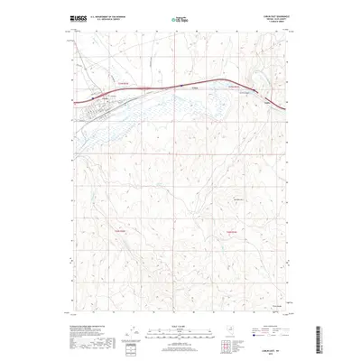
2018 Map of Carlin East
USGS Topo · Published 2018About this map
The Humboldt River carves a critical path through the High Desert of Elko County, anchoring the town of Carlin and the surrounding basin. This area represents a vital transportation corridor where modern infrastructure follows historical routes through Carlin Canyon, a dramatic passage through the limestone cliffs. To the north, Greenhorn Cutoff suggests the path of early pioneers, while the grid of Carlin includes established landmarks such as the Carlin Cem and streets like Railroad St and W Main St that reflect its heritage as a rail hub. The terrain transitions from the river valley into the foothills of the Pinon Range, dotted with isolated water sources like Rye Patch Spring and the drainage of Woodruff Cr. Small sidings and settlements such as Vivian and Tonka line the river, marking the continued importance of the corridor for industry and transit.
Find a feature on this map
39 named features on this map. Tap any name to fly to it.
Don’t see what you’re looking for? This feature index may not catch every label — zoom into the map to look around manually.
Map Details
Editions of this 2018 Carlin East Map
This is the sole edition of this map. No revisions or reprints were ever made.
Other maps of this area

1952 · Dixie Flats
USGS Topo · 1:62,500

1952 · Carlin
USGS Topo · 1:62,500

1955 · Winnemucca
USGS Topo · 1:250,000

1955 · Elko
USGS Topo · 1:250,000

1958 · Winnemucca
USGS Topo · 1:250,000

1958 · Elko
USGS Topo · 1:250,000

1958 · Hunter
USGS Topo · 1:24,000

1958 · Huntsman Ranch
USGS Topo · 1:24,000

1962 · Elko
USGS Topo · 1:250,000

1962 · Winnemucca
USGS Topo · 1:250,000