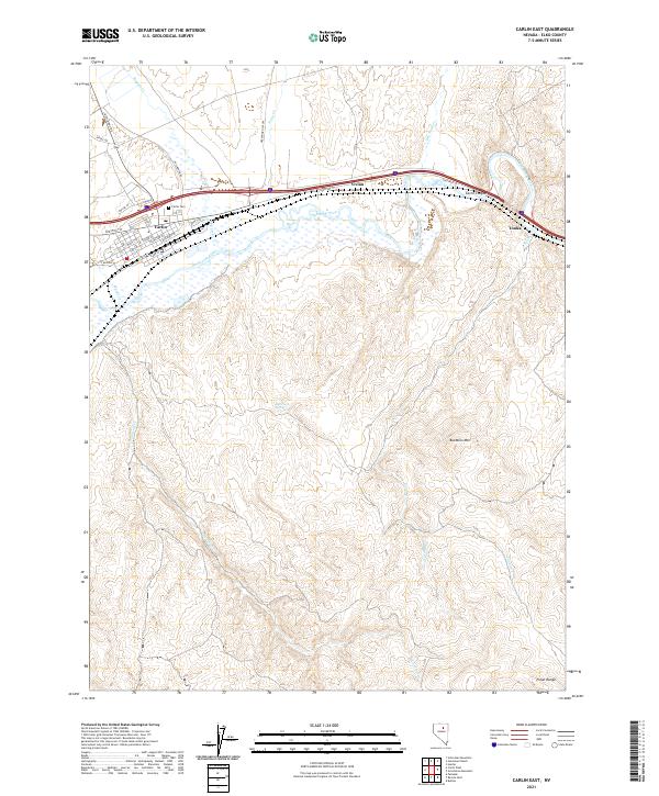
2021 Map of Carlin East
USGS Topo · Published 2021About this map
Carlin serves as the primary hub along the Humboldt River, where an established street grid including Chestnut St and W Main St meets the historic transcontinental transportation corridor. The landscape is defined by the river’s path as it winds through Carlin Canyon, flanked by the smaller settlements of Vivian and Tonka. To the north, the Greenhorn Cutoff suggests early bypass routes across the high desert, while the northern reaches are drained by Maggie Creek and Susie Creek. Significant elevation changes are marked by Buckskin Mountain and the northern edge of the Pinon Range. This modern survey records the enduring footprint of Great Basin settlement, from the Carlin Cemetery to secluded water sources like Rye Patch Spring, illustrating how topography dictated the development of rail and road networks in Elko County.
Find a feature on this map
41 named features on this map. Tap any name to fly to it.
Don’t see what you’re looking for? This feature index may not catch every label — zoom into the map to look around manually.
Map Details
Editions of this 2021 Carlin East Map
This is the sole edition of this map. No revisions or reprints were ever made.
Other maps of this area

1952 · Dixie Flats
USGS Topo · 1:62,500

1952 · Carlin
USGS Topo · 1:62,500

1955 · Winnemucca
USGS Topo · 1:250,000

1955 · Elko
USGS Topo · 1:250,000

1958 · Winnemucca
USGS Topo · 1:250,000

1958 · Elko
USGS Topo · 1:250,000

1958 · Hunter
USGS Topo · 1:24,000

1958 · Huntsman Ranch
USGS Topo · 1:24,000

1962 · Elko
USGS Topo · 1:250,000

1962 · Winnemucca
USGS Topo · 1:250,000