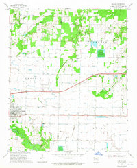
1964 Map of Carlisle
USGS Topo · Published 1965About this map
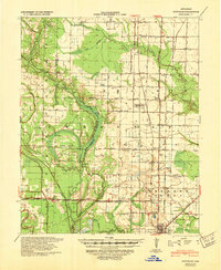
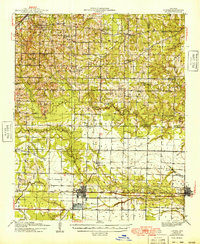
The Chicago Rock Island and Pacific railroad forms a straight east-west corridor through this central Arkansas landscape, anchoring the settlements of Carlisle and Screeton during the mid-1960s. This survey records a transition in regional infrastructure, notably showing a major highway as under construction just north of the rail line. The prairie terrain is defined by an extensive network of irrigation flumes and wells, feeding into the agricultural rhythm of Lonoke Co and Prairie Co.
Find a feature on this map
29 named features on this map. Tap any name to fly to it.
Don’t see what you’re looking for? This feature index may not catch every label — zoom into the map to look around manually.
Map Details
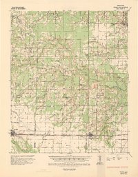
Editions of this 1964 Carlisle Map
This is the sole edition of this map. No revisions or reprints were ever made.
Other maps of this area
1935 · Hazen
USGS Topo · 1:62,500
1937 · Stuttgart
USGS Topo · 1:62,500
1937 · England
USGS Topo · 1:48,000
1939 · Stuttgart
USGS Topo · 1:62,500
1940 · Lonoke
USGS Topo · 1:62,500
1941 · Hazen
USGS Topo · 1:62,500
1943 · England
USGS Topo · 1:62,500

1948 · Helena
USGS Topo · 1:250,000
1949 · Lonoke
USGS Topo · 1:62,500

1950 · Helena
USGS Topo · 1:250,000