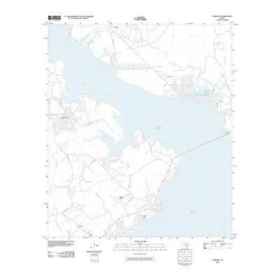
2010 Map of Carlisle
USGS Topo · Published 2010About this map
The Livingston Reservoir dominates this East Texas landscape, where the inundated valley of the Trinity River meets the growing residential developments along its shoreline. Small communities like Carlisle and Waterwood define the northern and western margins of the water, connected by a network of secondary roads such as FM 356 and FM 980. These routes traverse the inland terrain, passing through locales like Jims Corner and near the elevated ground of Darby Hill. For genealogists and local historians, the Liberty Hill Cemetery stands as a significant point of interest in the southern portion of the quadrangle. The map also traces the complex hydrology of the region, including the winding paths of Palmetto Creek, Mill Creek, and Brushy Creek as they feed into the primary reservoir.
Find a feature on this map
36 named features on this map. Tap any name to fly to it.
Don’t see what you’re looking for? This feature index may not catch every label — zoom into the map to look around manually.
Map Details
Editions of this 2010 Carlisle Map
This is the sole edition of this map. No revisions or reprints were ever made.
Other maps of this area

1954 · Beaumont
USGS Topo · 1:250,000

1957 · Beaumont
USGS Topo · 1:250,000

1960 · Blanchard
USGS Topo · 1:24,000

1960 · Colita
USGS Topo · 1:24,000

1960 · Trinity East
USGS Topo · 1:24,000

1960 · Carlisle
USGS Topo · 1:24,000

1960 · Stephen Creek
USGS Topo · 1:24,000

1961 · Staley
USGS Topo · 1:24,000

1961 · Onalaska
USGS Topo · 1:24,000

1961 · Oakhurst
USGS Topo · 1:24,000