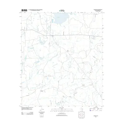
2013 Map of Carlos
USGS Topo · Published 2013About this map
The community of Carlos and the neighboring settlement of Piedmont define this portion of central Grimes County, an area characterized by a complex network of waterways feeding into the Gibbons Cr Reservoir. For genealogists and local historians, the landscape is dotted with several family and community burial sites, including Pleasant Hill Cem, Allen Cem, Kennard Cem, and Little Flock Cem. The presence of Piedmont Springs and Sulphur Springs suggests a legacy of mineral water and natural springs that historically drew visitors to this region. The map also reveals numerous small water bodies such as Carlos Lake, Blue Lake, and Moody Lake, along with a dense system of seasonal and perennial creeks like Peach Cr and Rocky Cr that drain the timbered plains.
Find a feature on this map
53 named features on this map. Tap any name to fly to it.
Don’t see what you’re looking for? This feature index may not catch every label — zoom into the map to look around manually.
Map Details
Editions of this 2013 Carlos Map
This is the sole edition of this map. No revisions or reprints were ever made.
Other maps of this area

1913 · Millican
USGS Topo · 1:31,680

1914 · Navasota
USGS Topo · 1:62,500

1954 · Beaumont
USGS Topo · 1:250,000

1954 · Austin
USGS Topo · 1:250,000

1956 · Carlos
USGS Topo · 1:62,500

1957 · Beaumont
USGS Topo · 1:250,000

1958 · Navasota
USGS Topo · 1:24,000

1959 · Millican
USGS Topo · 1:24,000

1959 · Reliance
USGS Topo · 1:24,000

1959 · Ferguson Crossing
USGS Topo · 1:24,000