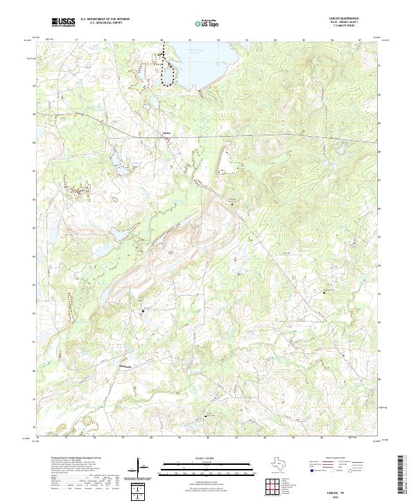
2022 Map of Carlos
USGS Topo · Published 2022About this map
Piedmont and the smaller settlement of Carlos define this landscape in Grimes County, where the terrain is marked by numerous springs and small creek drainages. The area is notable for its legacy of water sources, including Piedmont Springs and Sulphur Springs, which hint at the region's historical value for livestock and early travelers. The northern portion of the map is dominated by larger water bodies like the Gibbons Creek Reservoir and Carlos Lake, while the southern reaches are crisscrossed by smaller tributaries such as Little Flock Cr and Rocky Cr.
Find a feature on this map
52 named features on this map. Tap any name to fly to it.
Don’t see what you’re looking for? This feature index may not catch every label — zoom into the map to look around manually.
Map Details
Editions of this 2022 Carlos Map
This is the sole edition of this map. No revisions or reprints were ever made.
Other maps of this area

1913 · Millican
USGS Topo · 1:31,680

1914 · Navasota
USGS Topo · 1:62,500

1954 · Beaumont
USGS Topo · 1:250,000

1954 · Austin
USGS Topo · 1:250,000

1956 · Carlos
USGS Topo · 1:62,500

1957 · Beaumont
USGS Topo · 1:250,000

1958 · Navasota
USGS Topo · 1:24,000

1959 · Millican
USGS Topo · 1:24,000

1959 · Reliance
USGS Topo · 1:24,000

1959 · Ferguson Crossing
USGS Topo · 1:24,000