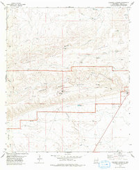
1979 Map of Carlsbad Caverns
USGS Topo · Published 1979About this map
Carlsbad Caverns National Park defines this landscape in the late 1970s, showing the developed infrastructure of the Visitor Center and the primary Cavern Entrance atop the limestone plateau. To the east, the settlement of Whites City stands at the park boundary, serving as a gateway for travelers. The map reveals the intricate drainage patterns of the Guadalupe Ridge, where named landmarks like Stetson Step and numerous deep-cut ravines like Walnut Canyon and Leonaguilla Canyon carve through the arid terrain. Natural water sources are critical here, evidenced by several mountain springs such as Mosley Spr and Robb Spring. In the lower elevations to the south, the Black River flows near man-made developments like the Sewage Disposal Ponds, reflecting the logistical needs of tourism and local settlement in Eddy County.
Find a feature on this map
39 named features on this map. Tap any name to fly to it.
Don’t see what you’re looking for? This feature index may not catch every label — zoom into the map to look around manually.
Map Details
Editions of this 1979 Carlsbad Caverns Map
2 editions found
Other maps of this area

1940 · Bandanna Point
USGS Topo · 1:62,500

1940 · Carlsbad Caverns West
USGS Topo · 1:62,500

1943 · Carlsbad Caverns West
USGS Topo · 1:62,500

1943 · Bandanna Point
USGS Topo · 1:62,500

1943 · West Carlsbad
USGS Topo · 1:62,500

1945 · West Carlsbad
USGS Topo · 1:62,500

1945 · Carlsbad Caverns East
USGS Topo · 1:62,500

1947 · Carlsbad Caverns East
USGS Topo · 1:62,500

1954 · Carlsbad
USGS Topo · 1:250,000

1958 · Carlsbad
USGS Topo · 1:250,000