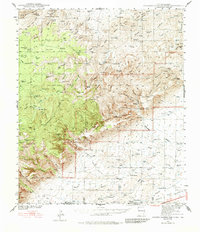
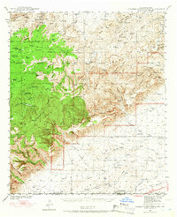
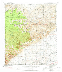
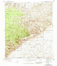
1940 Map of Carlsbad Caverns West
USGS Topo · Published 1984About this map
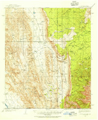
The high desert canyons and limestone ridges of the Guadalupe Mountains dominate this 1940 landscape, surveyed by Max J. Gleissner and C. E. Walker. The settlement of Queen (Ruins) appears as a collection of remnants, while cattle ranching defines the human footprint across the rugged terrain, evidenced by family holdings like Montgomery Ranch, Sehermeyer Ranch, and XT Ranch. Water management is critical in this arid environment, marked by numerous named tanks such as Reed Tank and Putman Tank, alongside natural features like Sitting Bull Falls within the Sitting Bull Recreational Area.
Find a feature on this map
85 named features on this map. Tap any name to fly to it.
Don’t see what you’re looking for? This feature index may not catch every label — zoom into the map to look around manually.
Map Details
Editions of this 1940 Carlsbad Caverns West Map
5 editions found
Other maps of this area

1933 · Guadalupe Peak
USGS Topo · 1:48,000
1935 · El Paso Gap
USGS Topo · 1:62,500

1936 · El Paso Gap
USGS Topo · 1:48,000

1940 · El Paso Gap
USGS Topo · 1:62,500

1940 · Guadalupe Peak
USGS Topo · 1:62,500
1940 · Bandanna Point
USGS Topo · 1:62,500
1940 · Carlsbad Caverns West
USGS Topo · 1:62,500

1943 · Carlsbad Caverns West
USGS Topo · 1:62,500

1943 · Bandanna Point
USGS Topo · 1:62,500
1943 · Texas Hill
USGS Topo · 1:62,500