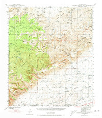
1940 Map of Carlsbad Caverns West
USGS Topo · Published 1973About this map
Queen Cem and the small settlement of Queen anchor the western reaches of this 1940 survey, documenting the rugged landscape of southern New Mexico before modern development. The map reveals a network of high-altitude ranching outposts such as Montgomery Ranch, Queen Ranch, and Schermeryer Ranch, linked by primitive trails through the Guadalupe Mountains. The prevalence of water features like Sitting Bull Spring and Carson Seep Ranger Sta underscores the critical importance of reliable water sources for both livestock and forestry management in this arid environment.
Find a feature on this map
86 named features on this map. Tap any name to fly to it.
Don’t see what you’re looking for? This feature index may not catch every label — zoom into the map to look around manually.
Map Details
Editions of this 1940 Carlsbad Caverns West Map
5 editions found
Other maps of this area

1933 · Guadalupe Peak
USGS Topo · 1:48,000

1935 · El Paso Gap
USGS Topo · 1:62,500

1936 · El Paso Gap
USGS Topo · 1:48,000

1940 · El Paso Gap
USGS Topo · 1:62,500

1940 · Guadalupe Peak
USGS Topo · 1:62,500

1940 · Bandanna Point
USGS Topo · 1:62,500

1940 · Carlsbad Caverns West
USGS Topo · 1:62,500

1943 · Carlsbad Caverns West
USGS Topo · 1:62,500

1943 · Bandanna Point
USGS Topo · 1:62,500

1943 · Texas Hill
USGS Topo · 1:62,500