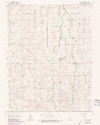
1964 Map of Carlton
USGS Topo · Published 1985About this map
The town of Carlton serves as the central hub of this agricultural landscape in Dickinson County, positioned where the Missouri Pacific railroad corridor cuts across the prairie. The topography is defined by the winding drainage systems of Holland Creek, including its West Holland and East Holland branches, which create a complex network of draws and ridges across the townships of Wheatland, Holland, and Banner.
Find a feature on this map
15 named features on this map. Tap any name to fly to it.
Don’t see what you’re looking for? This feature index may not catch every label — zoom into the map to look around manually.
Map Details
Editions of this 1964 Carlton Map
3 editions found
Other maps of this area

1889 · Abilene
USGS Topo · 1:125,000

1894 · Abilene
USGS Topo · 1:125,000

1955 · Kipp
USGS Topo · 1:24,000

1955 · Gypsum
USGS Topo · 1:24,000

1955 · Hutchinson
USGS Topo · 1:250,000

1959 · Hutchinson
USGS Topo · 1:250,000

1963 · Abilene SW
USGS Topo · 1:24,000
1963 · Holland
USGS Topo · 1:24,000

1964 · Elmo
USGS Topo · 1:24,000

1964 · Carlton
USGS Topo · 1:24,000