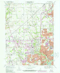
1967 Map of Carmel
USGS Topo · Published 1988About this map
The boundary between Hamilton and Marion County reveals a rapidly diversifying suburban landscape in the late 1960s, punctuated by purple-tinted updates from the late 1970s. The northern sector is anchored by Carmel, while the southern portion transitions into the residential developments of Meridian Hills and Washington Township. Significant institutional footprints include the sprawling State Sch for the Blind and several parochial and public institutions like Brebeuf Sch and North Central High Sch.
Find a feature on this map
106 named features on this map. Tap any name to fly to it.
Don’t see what you’re looking for? This feature index may not catch every label — zoom into the map to look around manually.
Map Details
Editions of this 1967 Carmel Map
4 editions found
Other maps of this area

1948 · Indianapolis East
USGS Topo · 1:24,000

1948 · Indianapolis West
USGS Topo · 1:24,000

1952 · Fishers
USGS Topo · 1:24,000

1952 · Carmel
USGS Topo · 1:24,000

1953 · Westfield
USGS Topo · 1:24,000

1953 · Rosston
USGS Topo · 1:24,000

1953 · Zionsville
USGS Topo · 1:24,000

1953 · Noblesville
USGS Topo · 1:24,000

1953 · Clermont
USGS Topo · 1:24,000

1953 · Danville
USGS Topo · 1:250,000