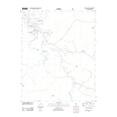
2012 Map of Carmel Valley
USGS Topo · Published 2012About this map
The Carmel River carves a path through this section of Monterey County, anchoring a landscape of established ranches and valley settlements. The concentrated residential development of Carmel Valley Village and Robles Del Rio contrasts with the surrounding topography, where the land rises sharply into named features like Osborne Ridge and Blue Rock Ridge. Local history is reflected in the numerous named estates and camps, including Holman Ranch, Rancho Del Monte, and the J Gardiners Tennis Ranch. The map traces a network of winding roads such as W Carmel Valley Rd and Cachagua Rd that follow the natural contours of the canyons and creeks. Notable smaller outposts like Princes Camp and Camp Stephani are situated along the river and its tributaries, illustrating the area's legacy as a destination for seasonal retreats and agriculture.
Find a feature on this map
50 named features on this map. Tap any name to fly to it.
Don’t see what you’re looking for? This feature index may not catch every label — zoom into the map to look around manually.
Map Details
Editions of this 2012 Carmel Valley Map
This is the sole edition of this map. No revisions or reprints were ever made.
Other maps of this area

1910 · Salinas
USGS Topo · 1:31,680

1912 · Salinas
USGS Topo · 1:62,500

1913 · Monterey
USGS Topo · 1:62,500

1918 · Point Sur
USGS Topo · 1:62,500

1920 · Jamesburg
USGS Topo · 1:48,000

1921 · Jamesburg
USGS Topo · 1:62,500

1925 · Point Sur
USGS Topo · 1:62,500

1939 · Jamesburg
USGS Topo · 1:62,500

1940 · Salinas
USGS Topo · 1:62,500

1940 · Jamesburg
USGS Topo · 1:62,500